Cleaning the map so that we can spend broadband funds efficiently
Recently I wrote about how there are too many locations in the National Broadband Map when you compare it with the recently-released Census count of housing units. In rural areas, there are 30.1 million housing and business units according the National Broadband Map, and 24.6 million housing units according to the Census. This isn’t just academic. Some (in fact many) of those extra locations are Unserved or Underserved.
Before the allocation, all the attention was on adding missing locations to the map. Now that we’re through the allocation, when you look ahead the problem is having too many [not real] Unserved locations, not too few. If there’s an Unserved location that isn’t real, we risk making a grant that won’t actually connect anyone — the broadband bridge to nowhere. Another common situation is Unserved locations in dense Served areas, where, ideally, we could serve the location without any grant program at all.
I’ve identified 633,254 unique locations that are either Unserved or Underserved and are suspicious in some way. If even half of them — and my tests suggest it’s more — are not truly in need of broadband service, that could be 316,000 extra locations, 3% of the national total of Unserved and Underserved locations.
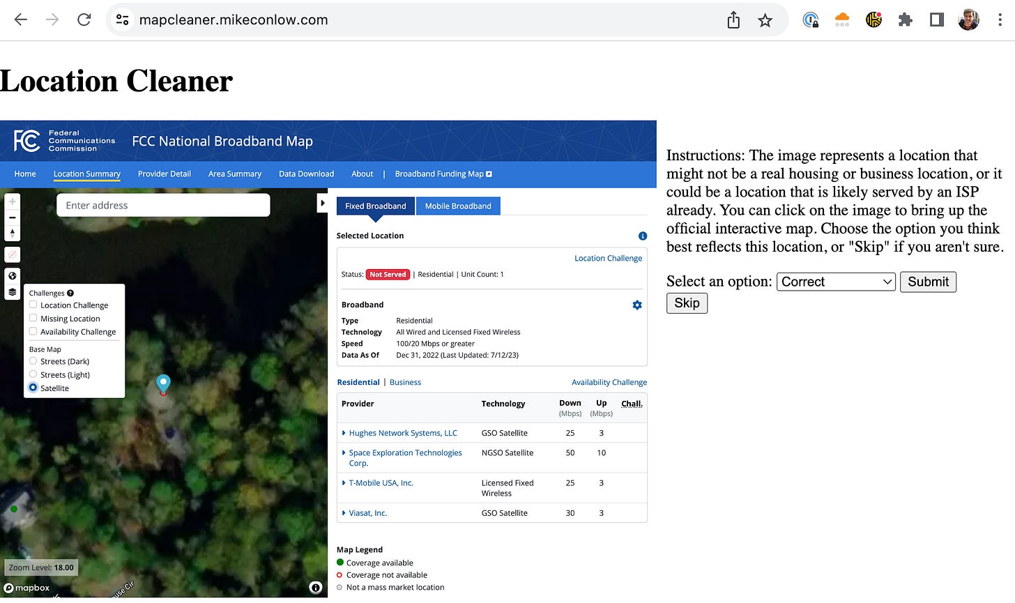
To show examples of this, I’ve loaded 600 random locations from this list into a quick Location Cleaner application I wrote, available here: https://mapcleaner.mikeconlow.com.
Here’s the distribution of the 633,254 locations by state, as a percentage of all Unserved and Underserved locations. (This assumes 100% of these suspicious locations are incorrect, so it’s an upper bound. But it’s also only the locations I’ve identified so far. There could be other suspicious locations.)
To be clear, I don’t put any blame for this on the FCC or CQA. As everyone now knows, coming up with a perfect national map of all “Broadband Serviceable Locations” is an impossible task. Then asking thousands of different ISPs to create new processes to layer on their coverage areas adds another level of difficulty. The concerted effort to add locations over the past few months also hasn’t helped this particular problem.
The definition of a “Broadband Serviceable Location” is itself squishy. The FCC says:
As an important first step, we adopt as the fundamental definition of a “location” for purposes of the Fabric: a business or residential location in the United States at which fixed broadband Internet access service is, or can be, installed.
It goes on to define a non-residential BSL:
We will treat the following as business locations in the Fabric: all non-residential (business, government, non-profit, etc.) structures that are on a property without residential locations and that would be expected to demand broadband Internet access service.
The FCC doesn’t, and couldn’t, define every type of location in the country and whether it could demand broadband service. This is an issue that Cost Quest told Congress about while Congress considered the Broadband DATA Act which created the Fabric, and I wrote about it for Slate in April 2021. As you’ll see if you click through some of the locations in the application, there are real questions to answer about whether remote ranches, agricultural structures, and other anomalies should really be BSLs.
I also don’t know exactly what should happen. One option is the state could submit problematic locations into the state challenge process. But NTIA has said states can’t submit challenges into its own process — they’d be acting as the plaintiff and the judge. I believe NTIA has also said that locations cannot be added or removed as part of the state challenge process.
Another option is a state could submit the locations to the FCC as location challenges. The challenge would be reviewed by the FCC and CQA, incorporated into the next release of the Fabric if successful, ISPs would then report coverage against that new Fabric, then it would come out in a new National Broadband Map. It would take a long time.
Maybe there is yet another option where a state could submit its plans to NTIA and ask for a waiver for certain locations that it deems not real or otherwise not needing BEAD funding. But NTIA has a statutory requirement to provide funding to 100% of the Unserved locations according to the National Broadband Map — not almost 100%, or 100% minus the ones the state decided aren’t real. There may not be an NTIA waiver escape hatch at all.
All of the above is mostly about locations that might not be real. But part of the issue you’ll see in the sample of locations is places where an ISP serves nearby locations but not the location in question. It’s conceivable that we may need a reverse coverage challenge — asking ISPs if they are sure they don’t serve a location.
In any of these cases, I think it would be ideal to have some level of community involvement. Removing the extraneous locations is important to overall efficiency. But we should not have much tolerance for accidentally removing a real family who really needs broadband. So giving communities (counties, towns, or the public) the ability to weigh in feels important.
If any states are interested in working directly on cleaning up state maps, please reach out by replying to the Substack email.


"Unserved locations in dense Served areas" are unserved for a reason -- usually because serving them would be prohibitively expensive. Perfect fit for grant funding.
Howdy Mike, would it be possible to make that list of potentially suspicious locations available?
Just looking for location IDs, really. Thanks!