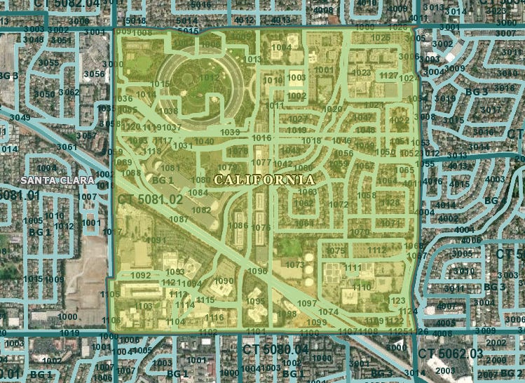
I’ve written about the data problems in RDOF on a couple occasions, but Mike Dano’s piece made me go back to one issue in particular: how does RDOF funding wind up in Apple’s HQ? (A special hat tip to Derek Turner at Free Press for originally writing about this issue and helping me through the documentation).
Apple’s HQ is part of a sizable census block group, which does include residential. Census block groups (a collection of Census blocks) are the lowest funding level of RDOF. ISPs bid to serve all the census blocks in a block group, even if that is only one block.
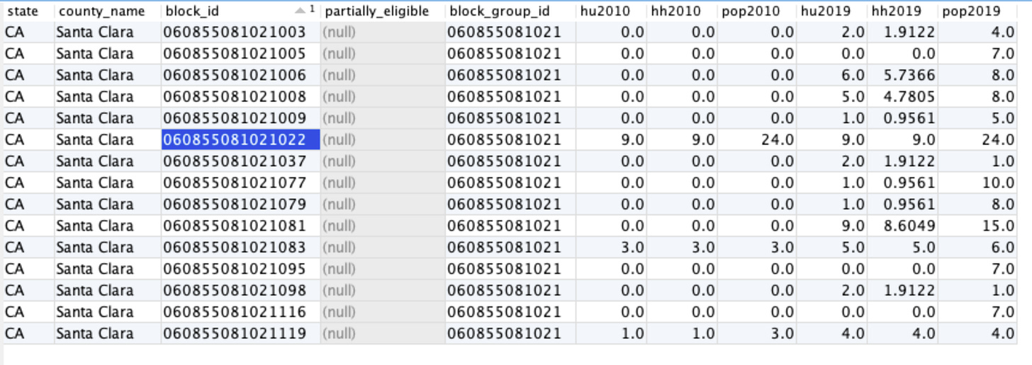
There were 15 blocks that were eligible for RDOF funding in this block group. A block is eligible if no ISP provides 25/3 broadband service according to the Form 477 data, and there are eligible locations in the block.
Something goes wrong at that step of calculating eligible locations. Of the 15 eligible blocks in this block group, 3 had population according to the 2010 census. One is on the other side of the block group away from Apple’s campus. Two others have 3 residents each, in the southwest of the Apple campus in the “Hampton Apartment Homes”. But all 15 blocks have population according to the FCC’s projection of 2019 population.
We can only take an educated guess at what happened. According to the Connect America Model documentation:
In CACM, Census Blocks are identified where there is no evidence of residential housing units. Evidence includes the 2010 Census Block information along with utilized 2011 GeoResults geocoded residential data. For those housing units placed via 2011 country (sic) growth into Census Blocks for which there is no evidence of residential locations, the housing unit was removed. The removed housing units are aggregated to the county level and then randomly placed into Census Blocks that have evidence of residential habitation. (emphasis added)
The FCC (and their vendor) appear to be making two corrections to the block-level data: addresses that didn’t geocode properly, and population growth over time. In both cases, from the documentation above, they’re attempting to redistribute those “missed” or new people across all the populated Census blocks. But there are tens of thousands of blocks for which this problem didn’t occur, including a number of them in this same block group.
My best guess at what happened: the geocoding of addresses that was done at some point in the past was not done against the same base map as the census data, and inadvertently geocoded some buildings into neighboring census blocks. Once a Census block appeared to have population, it would have been eligible to receive more population in non-geocodable and population growth adjustments. By the time the 2019 population projections come around, the blocks have a couple “people” in them, are still “unserved” (because the ISP isn’t going to report road medians), and they become eligible for RDOF.


